This 38th Student Poster Program of the OCEANS Conferences was held at OCEANS’16 MTS/IEEE Shanghai, at the Shanghai International Convention Center & Oriental Riverside Hotel, from April 10 to April 13. The program was organized by Dr. Ye Li (Shanghai Jiao Tong University) as local coordinator and Philippe Courmontagne, SPC Chair, from IEEE OES.
For this edition, more than 100 abstracts were received and 17 were selected for this contest, not without difficulty given the high quality of the received abstracts, only 14 students were able to attend the conference. Students came from Brazil, Canada, China, France, Japan, Korea, Portugal, Spain, Taiwan and the United States.
The posters were on display in the Exhibition Hall. As for the previous Student Poster Competitions, outstanding posters describe the work that the students were presenting and were particularly appreciated by the attendees of the conference. Moreover, the student participants greatly appreciated the opportunity to display, exchange and describe their research work to the community.
The posters were judged by a team organized by IEEE OES and the local chair. The roster of students and their schools are (in order of appearance of the Program Book):
- Guang Chen, Shanghai Jiao Tong University
- Wei-Kuo Yen, National Taiwan University
- Taijie Luo, South China University of Technology
- Kai Huang, Zhejiang University
- José Melo, Faculty of Engineering, University of Porto
- Oriol Pallares Valls, SARTI-UPC
- Junjun Cao, State Key Laboratory of Ocean Engineering, Institute of Technology, Shanghai Jiao Tong University
- Amanda Duarte, Federal University of Rio Grande
- Jing Hao, Graduate School at Shenzhen, Tsinghua University
- Jonghyun Ahn, Kyushu Institute of Technology
- Redouane Lguensat, Telecom Bretagne
- Yali Wang, Memorial University of Newfoundland
- Jungwook Han, KAIST
- David R. Silver, United States Naval Academy
 |
 |
 |
 |
| The awards ceremony |
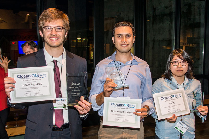
The judging was completed by noon on Wednesday and the prizes were awarded during the Wednesday’s lunch. Dr. Ye Li opened the awards ceremony and presented, with Philippe Courmontagne, each student with a Certificate of Participation in the OCEANS’16 MTS/IEEE Shanghai. Then, Philippe Courmontagne presented the third place winner to Jungwook Han, from Korea. Next, Adrew Clark, MTS Vice President for Industry and Technology, presented the second prize to Jonghyun Ahn, from Japan. The first price, the “Norman Miller’s Price”, has been presented by René Garello, IEEE OES President, to Redouane Lguensat, from France, for his poster entitled “Using Archived Datasets for Missing Data Interpolation in Ocean Remote Sensing Observation Series”. The Winning Paper is included beginning on page 35. In addition, for this contest, three special prizes “the OCEANS’16 Shanghai” prizes, have been put in place: two special third prizes, presented by Ye Li to Oriol Pallares, form Spain and to Yali Wang, from Newfoundland.and one special second prize, presented by Wen Xu, the Technical Program Chair, to Jolé Melo, from Portugal.
The audience gave the students a big hand following the awards presentations. The session ended with a photograph session.
The roster of students and their poster titles are given below with an abstract of their paper.
 Guang Chen, Shanghai Jiao Tong University
Investigation of free surface flow in wedge water entry problem using Smoothed Particle Hydrodynamics method
Wedge water entry problem is investigated and induced free surface flow problem is studied through Smoothed Particle Hydrodynamics (SPH) method. Firstly, the SPH model is introduced briefly, including numerical approximation, the discretized governing equations, boundary treatment and time stepping algorithm. Then the SPH method is validated by experimental results for further investigations. Afterwards, several wedge water entry cases are tested. The displacement, velocity and dimensionless acceleration of the wedge are quantitatively analysed. Furthermore, motion of the free surface is gotten, and results show that water particles on free surface will move near the free surface during the simulation process. Lastly, splashed out particles are examined. It is found that these particles are almost coming from one fixed region, a w-shape like region. It is proven that SPH method is good to simulate free surface flow problems.
 Wei-Kuo Yen, National Taiwan University
Wall Following Control of a Robotic Fish using Dynamic Pressure
This work controlled a robotic fish swimming alongside a wall. Research shows that fish swimming alongside a wall use lateral lines to obtain nearfield information. This concept is also applicable in man-made underwater vehicles such as robotic fish, which mimic the swimming action of a fish. Pressure sensors on the surface of a robotic fish measure hydrodynamic pressure variation. According to two-dimensional potential flow theory and the image method, the pressure variation caused by a robotic fish swimming near a wall is related to the relative angle and distance between the robot and the wall. Thus, the pressure signals can be used as feedback and inputs for controlling the direction in which the robot swims. The experimental results of this study show that a robotic fish 90 cm long can swim alongside a straight wall approximately 30–40 cm away (0.33–0.44 body length, 1–1.33 tail fin height). This method can also be combined with a well-designed strategy for using a robotic fish to swim next to an underwater structure to inspect details of structure parts.
 Taijie Luo, South China University of Technology
Cramér-Rao Bounds of Source Localization with Distributed Sensors in Underwater Multipath Environment
In this paper, the Cramér-Rao lower bounds (CRLB) and the maximum likelihood estimator (MLE) are derived for estimating the underwater source location. An underwater source, four distributed underwater receivers with known location and time synchronization between source and receivers are assumed. If the reflecting geometry is known and the multipath is detectable and resolvable, it is shown that with exploiting the multipath information, the accuracy of source location estimation can be improved. Numerical examples are presented to illustrate the behavior of these bounds.
 Kai Huang, Zhejiang University
Sequential Filtering Applied to Multi-Beam Echo-Sounding
A precise ocean bottom map is often desired for ocean surveying. To meet the demand, the multi-beam echo sounder (MBES) has been developed and commonly used. An MBES usually forms multiple receiving beams across-track first, then determines the bottom echo time for each beam, and finally calculates depth from echo time and direction. In this paper, a sequential filtering approach, exploiting ping to ping data correlation, is proposed, which is capable of realizing fast and accurate estimation and tracking of the seafloor depth. By the employment of this method, when the measurement Signal-Noise-Ratio (SNR) is below 35dB, the root mean square error (RMSE) of depth estimation is much lower than the conventional approach, and nearly reaches the posterior Cramer–Rao lower bound. The results demonstrate that the sequential filtering approach, applied to MBES measurements, could be a promising technique for seafloor topography estimation and tracking.

 José Melo, Faculty of Engineering, University of Porto
Towards LBL Positioning Systems for Multiple Vehicles
In this article we discuss the use of LBL acoustic networks for operations with multiple AUVs. Differently from standard LBL configurations, we propose to use the One-Way-Travel-Time of acoustic signals to
compute the ranges between all the devices. Moreover, we derive the suitable algorithms for both the navigation of multiple vehicles, but also their external tracking. Experimental results are provided that support the evidence that our approach is successful in operations for multiple vehicles.

 Oriol Pallares Valls, SARTI-UPC
Time Synchronization Accuracy Refinement for Mobile Shallow Water Acoustic Sensor Network
Time synchronization is an important factor to take into account when performing collaborative and distributed tasks along a sensor network. Message exchange based time synchronization algorithms ported to underwater acoustic sensor networks, have to deal with high latency communications, besides frame Doppler scaling and frame detection at the receiver side, which are key points for an accurate synchronization. Furthermore, mobile sensor networks lead to different propagation times in a bidirectional message exchange, such as the ones used to synchronize two sensors. In addition to time synchronization algorithm, a first order kinematic model in conjunction with Doppler estimation can be applied to precise frame time stamping and avoid drift between clocks.
In this paper we present a complete time synchronization scheme optimized for mobile network, tested in simulation and experimented in real tests demonstrating high performance in time synchronization accuracy.
 Junjun Cao, State Key Laboratory of Ocean Engineering, Institute of Technology, Shanghai Jiao Tong University
Seagull-Designed for Oceanographic Research
Seagull is a small fully functional underwater glider designed for oceanographic research with 1 knot operating speed and six months duration. In this paper, we present the design of this glider and analyze its performance. The Seagull glider uses a piston-based buoyancy engine system with an inexpensive gear pump as the main system actuator. The Seagull’s emergency release system is characterized for low power consumption. Towing experiments are performed to measure the accurate hydrodynamic coefficients of the glider. The operation of Seagull and the results of field trials in Qiandao Lake are reported.
 Amanda Duarte, Federal University of Rio Grande
A Dataset to Evaluate Underwater Image Restoration Methods
Image restoration methods have been made to repair images that have some kind of degradation. Most of these methods are designed to deal with the degradation caused by the over-land effects. However, when the images was captured in underwater environments, there are different properties that can degrade the image in unusual ways. This work aims to evaluate how the popular image restoration methods behaves when applied in underwater images with the presence of turbidity in the water. For this, we propose a dataset where we are able to control the amount of image degradation due to underwater properties on a scenario with 3D objects that represents the seabed characteristics. After that, we evaluate the restoration of these methods and their behavior through the image degradation due to turbidity.
 Jing Hao, Graduate School at Shenzhen, Tsinghua University
Saliency Segmentation and Foreground Extraction of Underwater Image based on Localization
Saliency detection aims at automatically estimating visually salient object regions in an image, saliency segmentation and foreground extraction are two important applications of this. However, it is a challenge for underwater images to estimate salient regions by conventional saliency detection methods because of the low-contrast and poor quality. In this paper, we address this problem by combining the detected object regions rather than the whole image, where Fish Localization is used for proposing candidate regions. We extensively evaluated our method on 780 underwater images, and experimental results show that the performances of saliency detection and segmentation are improved. These saliency segmentation masks are further used to extract the foreground objects of an image. It is well proved that our approach is fast and efficient for underwater images which are low-contrast, poor quality and with multiple salient objects.

 Jonghyun Ahn, Kyushu Institute of Technology
Image Enhancement and Compression of Deep-Sea Floor Image for Acoustic Transmission
One of the important missions of AUVs is to take deep-sea images and make maps of sea floor to contribute the understanding of deep-sea biology and geology. The sea floor images include lots of information such as distributions of creatures, minerals and so on. The next mission expected for AUVs is to bring the samples back concurrently with taking interesting photos, autonomously. However, this mission is difficult to perform fully-autonomous without the knowledge of biologists or geologists, as the AUVs don’t know which objects are interesting or important for them and it takes long time to teach AUVs all features of target samples. It is necessary for AUVs to work semi-autonomously by collaborating with scientists on the ship and getting commands to indicate the important samples. In this research, we proposed an image enhancement and compression method for acoustic transmission with limited communication density. The proposed method enhances the effect of light attenuation in the deep-sea floor image and reduces the image depth from 24-bit of original images to 4-bit. The method is evaluated by transmission experiment using a new AUV “TUNA-SAND 2”.

 Redouane Lguensat, Telecom Bretagne
Using Archived Datasets for Missing Data Interpolation in Ocean Remote Sensing Observation Series
The proliferation of data coming in daily from ocean remote sensing observational networks is getting bigger and will likely to get a lot bigger. This fact makes it natural to search for methods and strategies that can make the best use of this wealth of information. In this work, we investigate the utility of historical datasets to missing data interpolation issues. We state missing data interpolation as a data assimilation issue and present a data-driven strategy for the reconstruction of missing data in remote sensing observations series. Our data-driven strategy exploits a Hidden Markov Model (HMM) formulation. We report numerical experiments for simulated geophysical dynamics and real SST observation series, which demonstrate the relevance of the proposed framework.

 Yali Wang, Memorial University of Newfoundland
Wind Speed Extraction from Rain-contaminated X-band Nautical Radar Data
In this paper, a new method for retrieving wind speeds from rain-contaminated X-band nautical radar images is presented. The method mitigates rain influence by applying the gamma correction to rain-contaminated images, and then relates the average intensities of radar images to the measured wind speeds with a logarithmic function. The method has been tested using X-band nautical radar images and shipborne anemometer data. A comparison with the anemometer data shows that the root mean square error of wind speeds retrieved from rain-contaminated radar images is reduced by 5.4 m/s.

 Jungwook Han, KAIST
Three-Dimensional Reconstruction of a Semi-Submersible Offshore Platform with an Unmanned Surface Vehicle
This paper addresses the three-dimensional (3D) reconstruction of a floating structure with an unmanned surface vehicle (USV). Onboard lidar and sonar sensors are employed to collect a volumetric point cloud of the structure both above and below the waterline. These measurements are obtained in the vehicle-fixed frame; thus, for successful 3D reconstruction, precision estimation of trajectory and attitude is required. GPS signals are severely deteriorated or unavailable near and under floating structures. Therefore, relative navigation with respect to the planar surfaces of their hull structures is performed in the framework of simultaneous localization and mapping (SLAM). This approach enables high-precision navigation and mapping near and under a large floating structure. A field experiment was performed in a semi-submersible offshore platform environment and the results are presented.
 David R. Silver, United States Naval Academy
Experimental Analysis of an Array of Oscillating Water Columns (OWCs) to Determine Feasibility of an Offshore Structure that Converts Ocean Wave Energy in Usable Power
This paper will first analyze the effect on power output and relative capture width utilizing experimental data from various configurations of four oscillating water columns in an array. Then, a case study will be performed on the feasibility of constructing an offshore structure that will utilize oscillating water columns (OWCs) with pneumatic wave energy conversion devices to harness and convert the ocean wave energy into useable power and power an offshore structure entirely by renewable resources.

Do not hesitate, join this huge family


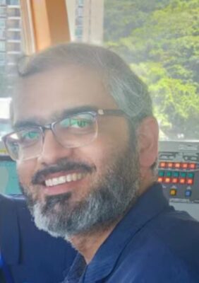 Suleman Mazhar has been working as a professor in Information & Communication Engineering at Harbin Engineering University (China) since July 2019. He did PhD from Tokyo University (Japan) and postdoctorate from Georgetown University (Washington DC, USA). He had BS-CS from FAST-NUCES (Lahore) and MS from GIK Institute (Pakistan). He is TYSP young scientist fellow (Ministry of Science & Technology China) and have won several research grants from international organizations such as DAAD (Germany), ICIMOD (Nepal), NRPU (Higher Education Commission Pakistan), WWF (Worldwide Fund for Nature) Pakistan. His research focus is deep learning and signal processing applications for environmental monitoring, with particular focus on underwater acoustics, and marine mammal conservation. He is a reviewer for professional journals such as Journal of Acoustical Society (America), IEEE Journal of Oceanic Engineering, IEEE Sensors Journal, Applied Acoustics, IEEE Transactions on Intelligent Transportation Systems.
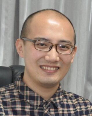 Peng Ren is a full professor with the College of Oceanography and Space Informatics, China University of Petroleum (East China). He is the director of Qingdao International Research Center for Intelligent Forecast and Detection of Oceanic Catastrophes. He received the K. M. Scott Prize from the University of York, the Natural Science award (first rank) from China Institute of Electronics, and the Eduardo Caianiello Best Student Paper Award from 18th International Conference on Image Analysis and Processing as one co-author. He has served as an associate editor of IEEE Transactions on Geoscience and Remote Sensing.
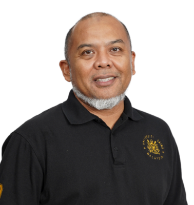 Mohd Rizal Arshad is a full professor at the School of Electrical and Electronic Engineering at Universiti Sains Malaysia (USM), Malaysia, where he specializes in ocean robotics technology and intelligent system. He received his B.Eng. in Medical Electronics & Instrumentation and PhD in Electronic Engineering from University of Liverpool, UK in 1994 and 1999, respectively. He completed his MSc. in Electronic Control Engineering from the University of Salford, UK in Dec 1995. He has supervised many postgraduate students and published extensively in local and international publications. He is a senior member of the IEEE, and was awarded IEEE OES Presidential Award in 2019.
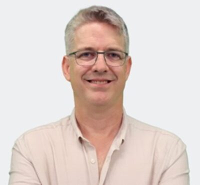 Itzik Klein is an Assistant Professor, heading the Autonomous Navigation and Sensor Fusion Lab, at the Charney School of Marine Sciences, Hatter Department of Marine Technologies, University of Haifa. He is an IEEE Senior Member and a member of the IEEE Journal of Indoor and Seamless Positioning and Navigation (J-ISPIN) Editorial Board. Prior to joining the University of Haifa, he worked at leading companies in Israel on navigation topics for more than 15 years. He has a wide range of experience in navigation systems and sensor fusion from both industry and academic perspectives. His research interests lie in the intersection of artificial intelligence with inertial sensing, sensor fusion, and autonomous underwater vehicles.
 John R. Potter (IEEE M’94, SM’02, F’18) graduated in the previous century with a joint honours Mathematics and Physics Degree from Bristol and a PhD. in Glaciology and Oceanography from Cambridge, UK studying Antarctic ice mass balance, where he spent four consecutive summers. This work helped underscore the non-linear fragility of polar ice to climate change and led to him receiving the Polar Medal from Queen Elizabeth II in 1988.
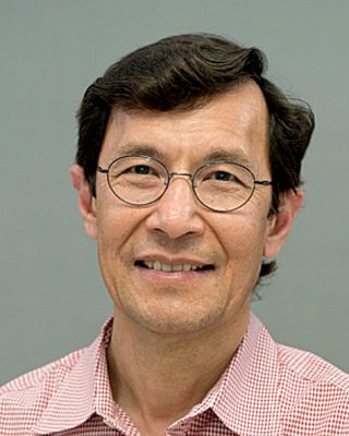 Nick is a Visiting Fellow at the UK National Oceanographic Center, Southampton His nomination was endorsed by the Underwater Acoustics Technology Committee. He had worked as a Research Associate and Lecturer at University of Birmingham and has been working as a Research Scientist at the Applied Research Laboratory, University of Texas, Austin. He has also served as a Program Officer at the Office of Naval Research Global. He is a senior member of IEEE (OES) and a Fellow of Acoustical Society of America (ASA). Nick has also been serving as Assoc. Editor for IEEE JoE and JASA. He is widely acknowledged for his expertise are seabed acoustics, parametric array modeling, sonar beamformer, underwater signal processing.
 Maurizio Migliaccio (M’91-SM’00-F’17) is Full professor of Electromagnetics at Università di Napoli Parthenope (Italy) and was Affiliated Full Professor at NOVA Southeastern University, Fort Lauderdale, FL (USA). He has been teaching Microwave Remote Sensing since 1994. He was visiting scientist at Deutsche Forschungsanstalt fur Lüft und Raumfahrt (DLR), Oberpfaffenhofen, Germany. He was member of the Italian Space Agency (ASI) scientific committee. He was member of the ASI CosmoSkyMed second generation panel. He was e-geos AdCom member. He was Italian delegate of the ESA PB-EO board. He was Member of South Africa Expert Review Panel for Space Exploration. He serves as reviewer for the UE, Italian Research Ministry (MIUR), NCST, Kazakhstan and Hong Kong Research board. He lectured in USA, Canada, Brazil, China, Hong Kong, Germany, Spain, Czech Republic, Switzerland and Italy. He was Italian delegate at UE COST SMOS Mode Action. He is listed in the Italian Top Scientists. He is an IEEE Trans. Geoscience and Remote Sensing AE, International Journal of Remote Sensing AE, and was IEEE Journal of Oceanic Engineering AE Special Issue on Radar for Marine and Maritime Remote Sensing, IEEE JSTARS AE of the Special Issue on CosmoSKyMed, Member of the Indian Journal of Radio & Space Physics Editorial board. His main current scientific interests cover SAR sea oil slick and man-made target monitoring, remote sensing for marine and coastal applications, remote sensing for agriculture monitoring, polarimetry, inverse problems for resolution enhancement, reverberating chambers. He published about 160 peer-reviewed journal papers on remote sensing and applied electromagnetics.
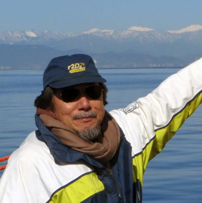 He has developed various types of Autonomous Underwater Vehicles (AUVs) and related application technologies including navigation methods, a new sensing method using a chemical sensor, precise seafloor mapping methods, a precise seabed positioning system with a resolution of a few centimeters, a new sensing system of the thickness of cobalt-rich crust; and more. He has shown, by using these technologies that AUVs are practicable and valuable tools for deep-sea exploration.
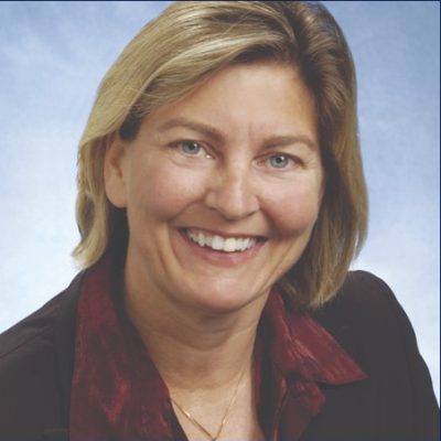 Donna Kocak has had an outstanding career in defense and scientific projects developing and applying solutions in subsea optics, imaging and robotics. She graduated with an M.Sc in Computer Science in 1997 from the University of Central Florida; an MBA in 2008 from the University of Florida; and M.Sc in Industrial Engineering in 2011 from the University of Central Florida. She is currently a Senior Scientist, Advanced Concepts Engineering, and Fellow at the Harris Corporation in Melbourne, Florida, where she has developed novel optical imaging and communication solutions for under-sea defense and scientific projects. Prior to 2008 Donna Kocak was Founder and President of Green Sky Imaging, LLC (GSI) who developed laser/video photogrammetry software for underwater inspection and survey. Her earlier career positions were with Naval Training Systems Center, Florida; Harbor Branch Oceanographic Institution, Florida; eMerge Interactive; and the Advanced Technologies Group in Florida.
 John Potter has a Joint Honours degree in Mathematics and Physics from Bristol University in the UK and a PhD in Glaciology and Oceanography from the University of Cambridge on research in the Antarctic, for which he was awarded the Polar Medal in 1988. John has worked on polar oceanography, underwater acoustics, ambient noise (including imaging), marine mammals, communications, IoUT, autonomous vehicles and strategic development. He has 40 years’ international experience working at the British Antarctic Survey in the UK, NATO in Italy, SIO in California, NUS in Singapore and most recently at NTNU in Norway. John is a Fellow of the IEEE and MTS, an Associate Editor for the IEEE Journal of Oceanic Engineering, IEEE OES Distinguished Lecturer, PADI Master Scuba Diver Trainer & an International Fellow of the Explorer’s Club.
 Dr. James V. Candy is the Chief Scientist for Engineering and former Director of the Center for Advanced Signal & Image Sciences at the University of California, Lawrence Livermore National Laboratory. Dr. Candy received a commission in the USAF in 1967 and was a Systems Engineer/Test Director from 1967 to 1971. He has been a Researcher at the Lawrence Livermore National Laboratory since 1976 holding various positions including that of Project Engineer for Signal Processing and Thrust Area Leader for Signal and Control Engineering. Educationally, he received his B.S.E.E. degree from the University of Cincinnati and his M.S.E. and Ph.D. degrees in Electrical Engineering from the University of Florida, Gainesville. He is a registered Control System Engineer in the state of California. He has been an Adjunct Professor at San Francisco State University, University of Santa Clara, and UC Berkeley, Extension teaching graduate courses in signal and image processing. He is an Adjunct Full-Professor at the University of California, Santa Barbara. Dr. Candy is a Fellow of the IEEE and a Fellow of the Acoustical Society of America (ASA) and elected as a Life Member (Fellow) at the University of Cambridge (Clare Hall College). He is a member of Eta Kappa Nu and Phi Kappa Phi honorary societies. He was elected as a Distinguished Alumnus by the University of Cincinnati. Dr. Candy received the IEEE Distinguished Technical Achievement Award for the “development of model-based signal processing in ocean acoustics.” Dr. Candy was selected as a IEEE Distinguished Lecturer for oceanic signal processing as well as presenting an IEEE tutorial on advanced signal processing available through their video website courses. He was nominated for the prestigious Edward Teller Fellowship at Lawrence Livermore National Laboratory. Dr. Candy was awarded the Interdisciplinary Helmholtz-Rayleigh Silver Medal in Signal Processing/Underwater Acoustics by the Acoustical Society of America for his technical contributions. He has published over 225 journal articles, book chapters, and technical reports as well as written three texts in signal processing, “Signal Processing: the Model-Based Approach,” (McGraw-Hill, 1986), “Signal Processing: the Modern Approach,” (McGraw-Hill, 1988), “Model-Based Signal Processing,” (Wiley/IEEE Press, 2006) and “Bayesian Signal Processing: Classical, Modern and Particle Filtering” (Wiley/IEEE Press, 2009). He was the General Chairman of the inaugural 2006 IEEE Nonlinear Statistical Signal Processing Workshop held at the Corpus Christi College, University of Cambridge. He has presented a variety of short courses and tutorials sponsored by the IEEE and ASA in Applied Signal Processing, Spectral Estimation, Advanced Digital Signal Processing, Applied Model-Based Signal Processing, Applied Acoustical Signal Processing, Model-Based Ocean Acoustic Signal Processing and Bayesian Signal Processing for IEEE Oceanic Engineering Society/ASA. He has also presented short courses in Applied Model-Based Signal Processing for the SPIE Optical Society. He is currently the IEEE Chair of the Technical Committee on “Sonar Signal and Image Processing” and was the Chair of the ASA Technical Committee on “Signal Processing in Acoustics” as well as being an Associate Editor for Signal Processing of ASA (on-line JASAXL). He was recently nominated for the Vice Presidency of the ASA and elected as a member of the Administrative Committee of IEEE OES. His research interests include Bayesian estimation, identification, spatial estimation, signal and image processing, array signal processing, nonlinear signal processing, tomography, sonar/radar processing and biomedical applications.
 Kenneth Foote is a Senior Scientist at the Woods Hole Oceanographic Institution. He received a B.S. in Electrical Engineering from The George Washington University in 1968, and a Ph.D. in Physics from Brown University in 1973. He was an engineer at Raytheon Company, 1968-1974; postdoctoral scholar at Loughborough University of Technology, 1974-1975; research fellow and substitute lecturer at the University of Bergen, 1975-1981. He began working at the Institute of Marine Research, Bergen, in 1979; joined the Woods Hole Oceanographic Institution in 1999. His general area of expertise is in underwater sound scattering, with applications to the quantification of fish, other aquatic organisms, and physical scatterers in the water column and on the seafloor. In developing and transitioning acoustic methods and instruments to operations at sea, he has worked from 77°N to 55°S.
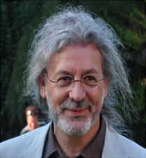 René Garello, professor at Télécom Bretagne, Fellow IEEE, co-leader of the TOMS (Traitements, Observations et Méthodes Statistiques) research team, in Pôle CID of the UMR CNRS 3192 Lab-STICC.
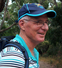 Professor Mal Heron is Adjunct Professor in the Marine Geophysical Laboratory at James Cook University in Townsville, Australia, and is CEO of Portmap Remote Ocean Sensing Pty Ltd. His PhD work in Auckland, New Zealand, was on radio-wave probing of the ionosphere, and that is reflected in his early ionospheric papers. He changed research fields to the scattering of HF radio waves from the ocean surface during the 1980s. Through the 1990s his research has broadened into oceanographic phenomena which can be studied by remote sensing, including HF radar and salinity mapping from airborne microwave radiometers . Throughout, there have been one-off papers where he has been involved in solving a problem in a cognate area like medical physics, and paleobiogeography. Occasionally, he has diverted into side-tracks like a burst of papers on the effect of bushfires on radio communications. His present project of the Australian Coastal Ocean Radar Network (ACORN) is about the development of new processing methods and applications of HF radar data to address oceanography problems. He is currently promoting the use of high resolution VHF ocean radars, based on the PortMap high resolution radar.
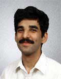 Hanu Singh graduated B.S. ECE and Computer Science (1989) from George Mason University and Ph.D. (1995) from MIT/Woods Hole.He led the development and commercialization of the Seabed AUV, nine of which are in operation at other universities and government laboratories around the world. He was technical lead for development and operations for Polar AUVs (Jaguar and Puma) and towed vehicles(Camper and Seasled), and the development and commercialization of the Jetyak ASVs, 18 of which are currently in use. He was involved in the development of UAS for polar and oceanographic applications, and high resolution multi-sensor acoustic and optical mapping with underwater vehicles on over 55 oceanographic cruises in support of physical oceanography, marine archaeology, biology, fisheries, coral reef studies, geology and geophysics and sea-ice studies. He is an accomplished Research Student advisor and has made strong collaborations across the US (including at MIT, SIO, Stanford, Columbia LDEO) and internationally including in the UK, Australia, Canada, Korea, Taiwan, China, Japan, India, Sweden and Norway. Hanu Singh is currently Chair of the IEEE Ocean Engineering Technology Committee on Autonomous Marine Systems with responsibilities that include organizing the biennial IEEE AUV Conference, 2008 onwards. Associate Editor, IEEE Journal of Oceanic Engineering, 2007-2011. Associate editor, Journal of Field Robotics 2012 onwards.
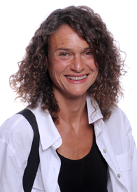 Milica Stojanovic graduated from the University of Belgrade, Serbia, in 1988, and received the M.S. and Ph.D. degrees in electrical engineering from Northeastern University in Boston, in 1991 and 1993. She was a Principal Scientist at the Massachusetts Institute of Technology, and in 2008 joined Northeastern University, where she is currently a Professor of electrical and computer engineering. She is also a Guest Investigator at the Woods Hole Oceanographic Institution. Milica’s research interests include digital communications theory, statistical signal processing and wireless networks, and their applications to underwater acoustic systems. She has made pioneering contributions to underwater acoustic communications, and her work has been widely cited. She is a Fellow of the IEEE, and serves as an Associate Editor for its Journal of Oceanic Engineering (and in the past for Transactions on Signal Processing and Transactions on Vehicular Technology). She also serves on the Advisory Board of the IEEE Communication Letters, and chairs the IEEE Ocean Engineering Society’s Technical Committee for Underwater Communication, Navigation and Positioning. Milica is the recipient of the 2015 IEEE/OES Distinguished Technical Achievement Award.
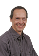 Dr. Paul C. Hines was born and raised in Glace Bay, Cape Breton. From 1977-1981 he attended Dalhousie University, Halifax, Nova Scotia, graduating with a B.Sc. (Hon) in Engineering-Physics.